
Montgomery County, Ohio
Maps
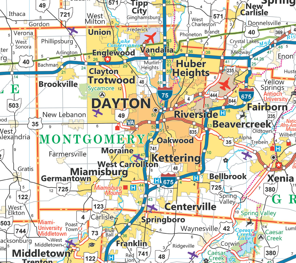
Dayton Road Map
The roads of Montgomery County, according to the Ohio Department of Transportation.

Dayton 5 Land Use Committees
Land use committees were once part of the priority board system. Now they are appointed by the city commission.
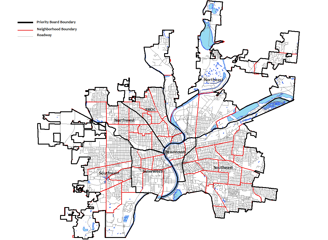
Dayton Priority Boards
The priority boards were designed to provide extra community representation in local government.
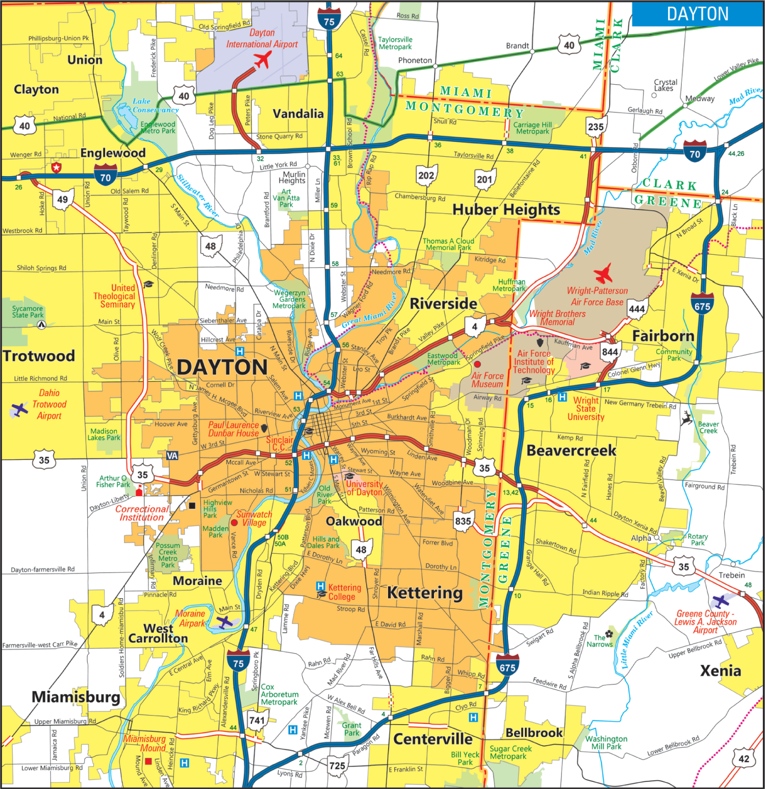
Dayton DOT Map
Map of Dayton roads according to Ohio Department of Transportation.

Dayton Police Department Beats
How Dayton is split up according to the local police force.
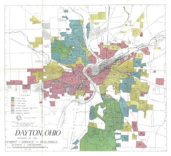
Dayton Redline Districts
“Redlining” was used to enforce segregation. Creditors and the government used these maps to determine who to provide services to and who not to.
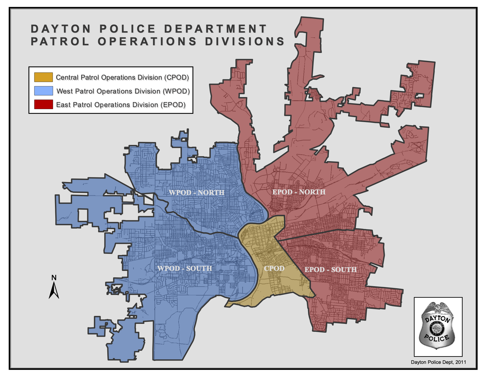
Dayton Police Department Divisions
One division for the predominantly black side of town and one division for the predominantly white side of town.
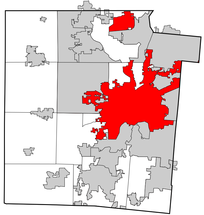
Montgomery_Dayton
Dayton looks like an octopus. The red splotch up north in Vandalia is the airport.
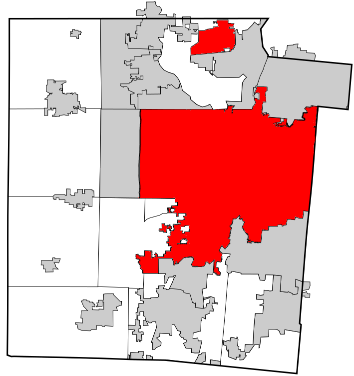
Dayton Reconstructed
This is what Dayton would look like if it merged with Riverside, Trotwood, Harrison Township, Moraine, and Oakwood.
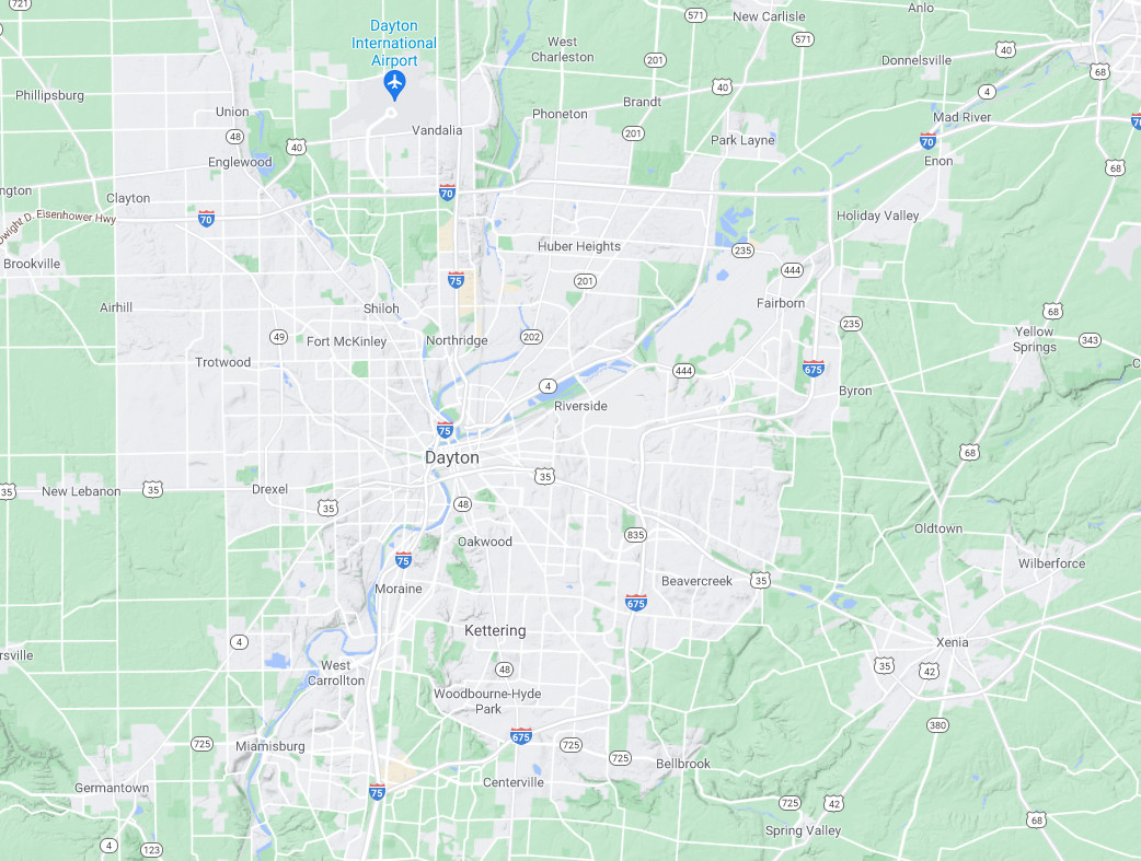
Google Maps Image of Dayton
If this map weren’t labeled, you would think all the connected gray parts were one city: Dayton.
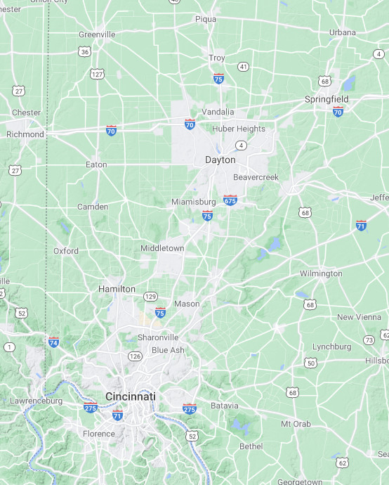
Map of Cincinnati & Dayton
The urban sprawl of the Dayton and Cincinnati Metro areas are joining around Middletown and Monroe.